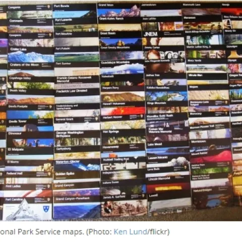
Kudos to Matt Holly, a member of the National Park Services (NPS) National Resource Stewardship and Science Directorate. Matt has been uploading all of the NPS maps into a single portal available online.
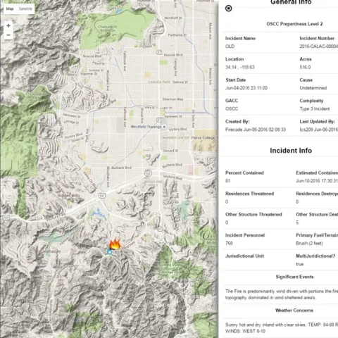
Want to keep tabs on fire incidient near you, your friends or family? Want to create an alert for your vacation cabin?Maybe just curious about digging deep into incident reports? The US Forest Serivce has released a beta web mapping application to do all that and more.
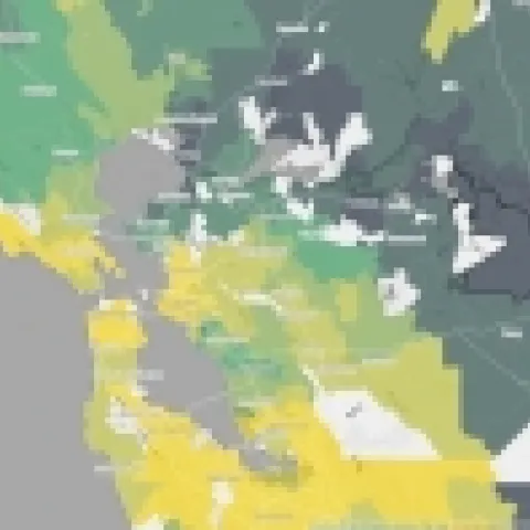
The Washington Post, using data from Black Knight Financial Services, recently published an amazing series of maps showing disparities in the United States' housing recoveries.
Some outstanding news was just released yesterday at the annual AUVIS Xponential 2016 conference in New Orleans, which will likely make it much easier to fly sUAS for educational purposes.