IGIS

Article

Post American fire imagery

October 22, 2013
Check out these images from after the American fire, from the WorldView 2 satelllite from our northern SNAMP site. The blue boundary is our SNAMP site. This background imagery is a pan-sharpened WV2 image (0.5 meters, channels 7, 5, 3).
View Article
Primary Image
image 18625
Article

California Geoportal Offers One-Stop Shop for Statewide GIS Data

October 8, 2013
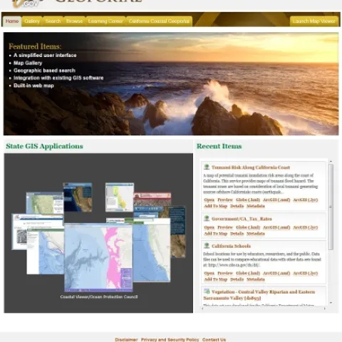
The California Geoportal, officially launched in March 2013 (see here for related launch press release), augments and in some ways replaces the original Cal-Atlas statewide GIS data download webpage with a more simplified, smooth, and more intuitive website for all GIS related data in the state.
View Article
Primary Image
image 18620
Article

New 2012-2013 SOD Confirmations Added to OakMapper!

October 8, 2013
New 2013 SOD Blitz and 2012-13 UC Davis DataNew confirmed cases of Sudden Oak Death (SOD) (P. ramorum) have been added to OakMapper, a project that tracks the spread of Sudden Oak Death from data collected by citizens and organizations.
View Article