IGIS

Article

Web mapping of high res imagery helps conservation

November 12, 2014
One of our collaborators on the Sonoma Vegetation Mapping Project has sent work on how web mapping and high resolution imagery has helped them do their job well. These are specific comments, but might be more generally applicable to other mapping and conservation arenas.
View Article
Article

New GIF Director: Nancy Thomas

November 4, 2014
The GIF welcomes our new Executive Director Nancy Thomas, who joins us Monday November 10th. Nancy comes to us from the Spatial Analysis Center at Stanford. She has over 18 years of experience in managing successful remote sensing and GIS projects in both consulting and academic arenas.
View Article
Primary Image
image 25769
Article

-

October 31, 2014
Violence against those who help manage and protect our public lands is an unfortunate reality in the United States. Though the recent Cliven Bundy standoff served to publicly highlight tensions between public lands managers and private citizens, that was not an isolated incident.
View Article
Primary Image
image 25689
Article

King fire burn severity

October 30, 2014
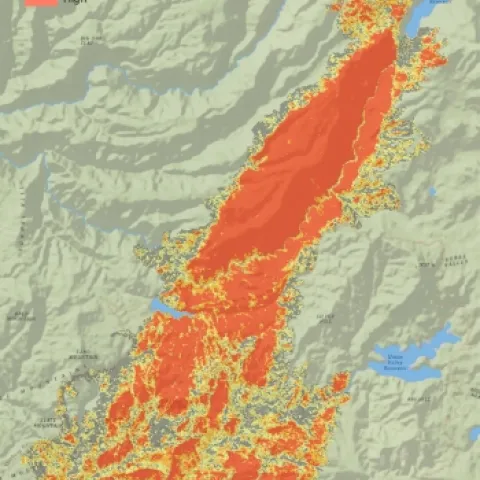
The King Fire is out, but it leaves us with alot to ponder. It started September 13 and quickly jumped on a northward run through National Forest and private forestlands. At the end, it burned 97,717 acres. 12 houses and several other minor structures were lost.
View Article