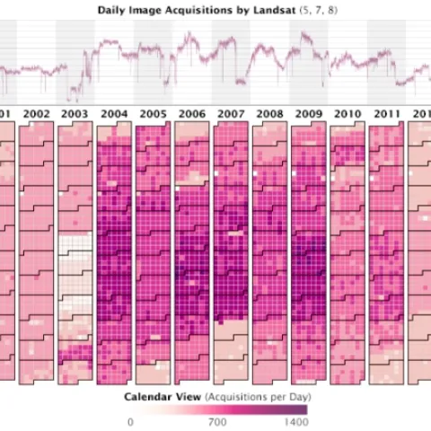
Very nice overview of how the Landsat archive has jump started new avenues in earth science, ecoinformatics, and public communication and participation. In 2008, the U.S. Geological Survey took 3.6 million images acquired by Landsat satellites and made them free and openly available on the Internet.